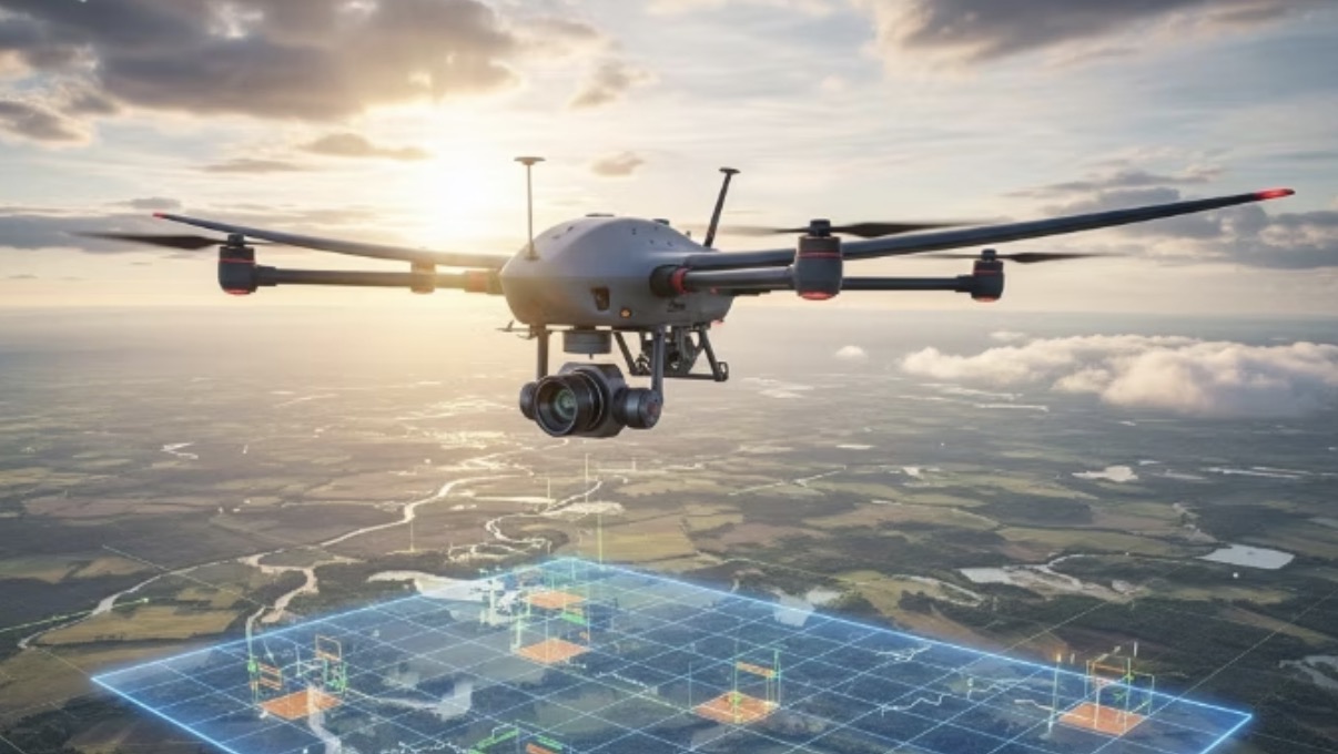
Intelligent Inspection UAV
Easy takeoff and landing, autonomous cruising, ultra-clear imaging, intelligent recognition
Overview
The Intelligent Inspection UAV is an integrated “fly-and-use” inspection platform combining easy takeoff and landing, autonomous cruising, ultra-clear imaging and intelligent recognition. It supports high-frame-rate multi-camera real-time compositing, row/column grid capture and instant tile-based display, with compliant AI object detection and anomaly annotation.
Use cases
- Rapid post-disaster situational awareness
- Fire / smoke monitoring
- Crop-growth inspection
- Urban facility inspection (street lights, manholes, greenery)
- Pipeline and asset inventory
Why choose us
- Faster: from capture to visualization in seconds — browse and annotate on site
- Clearer: multi-camera compositing and adaptive resolution capture every key detail
- More economical: on-demand loading of high-res tiles saves link bandwidth and storage
- More assured: end-to-end audit and permission management — compliant, traceable, deliverable
Core Technology
Multi-resolution pyramid browsing
- Network-adaptive elastic tiles (256/512px, croppable on demand), seamless zoom, with the UI showing the current estimated GSD/resolution in real time.
Panorama / orthophoto linkage
- The left (or top) panel provides panoramic situational navigation; the right shows the corresponding high-res orthophoto tile;
- Click to link and locate, instantly loading high-res patches of key areas.
Timeline / difference comparison
- Easily overlay multi-temporal imagery and compare before/after with a slider;
- Difference heat maps highlight changed areas, with threshold adjustment and regional statistics.
Human interaction & QA
- Alerts can be filtered by confidence and category; each alert has a thumbnail, location, time and QA buttons (reviewed / suspected / rejected);
- Quality layers can be toggled: blur, stitching seams, exposure anomalies, etc., for quick assessment of data usability.
Manual annotation & collaborative review
- Supports point/box/polygon annotation, comments and batch export (GeoJSON / STAC Item);
- Multi-user collaborative review, retaining operation history and audit trails for re-check and traceability.
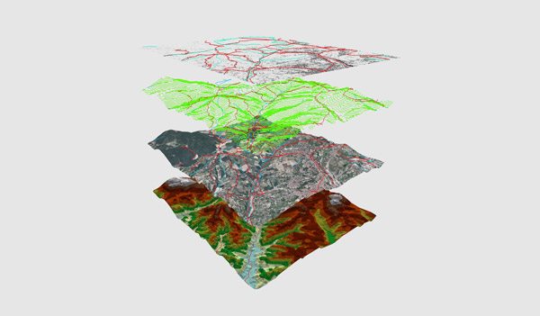
Component Architecture
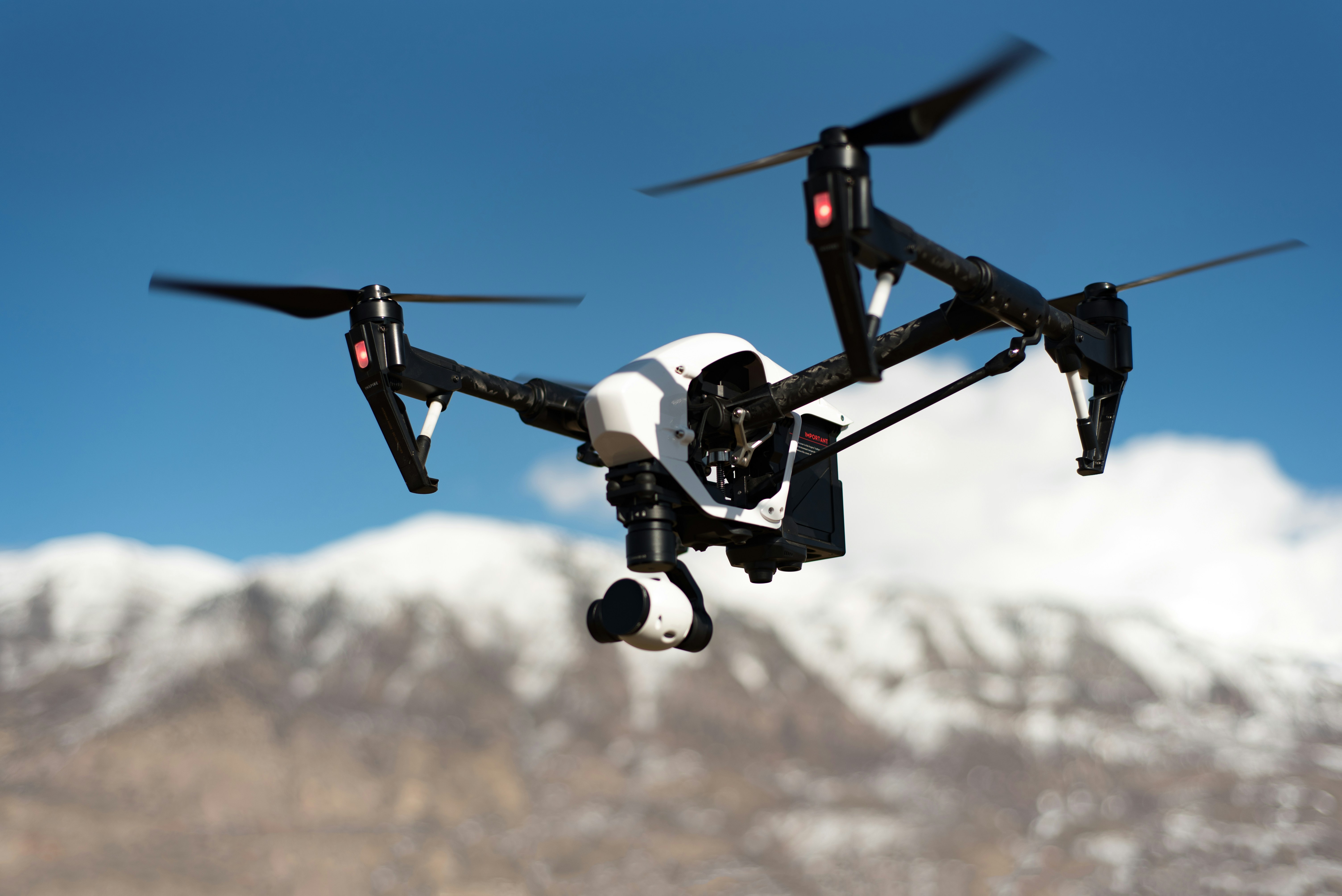
Airframe
- Multi-rotor or fixed-wing UAVs with stabilized gimbals or multi-camera arrays, adapting to varied operating radii and endurance.
Positioning & attitude
- RTK/PPK GNSS + high-speed IMU, frame-level time sync (PPS or hardware trigger), ensuring consistency between imagery and trajectory.
Onboard edge computing
- Handles “capture-and-view” fast processing: image correction, composite preview, quick encoding (Quicklook) and lightweight AI recognition;
- Common hardware: GPU/NPU/FPGA, with compute and power configurable per mission.
Transmission & communication
- Low-latency video links ensure on-site imagery;
- 4G/5G/private-network backhaul of key tiles/patches meets the connectivity needs of varied environments.
Ground / cloud services
- Real-time tile services (WMTS/XYZ), high-precision AI recognition, STAC cataloging and result archiving (COG/GeoTIFF/object storage).
Management & audit
- Role-based permissions, data encryption, logging and traceback (hash / on-chain signature optional) — fully traceable end to end.
Key Advantages
Flight planning tailored to the mission
- Supports grid (row/column) flight and zoned capture plans;
- Forward/side overlap (typically 70–85% forward, 60–80% side) is recommended automatically per mission to improve result quality.
Controllable resolution and GSD
- Balance “wide-angle situational view” and “close-up detail” through flight altitude and lens combinations;
- Provides achievable GSD ranges for disaster assessment, agricultural inspection and municipal asset inventory.
More efficient multi-camera layout
- Circumferential panorama provides full coverage; the down-facing lens focuses on key detail;
- Switch sampling/exposure by scene to handle differences in light and texture.
More reliable time synchronization
- Unified frame IDs and timestamps ensure reliable downstream positioning, comparison and archiving.
One-click “usable imagery”
- Stable, clear situational views and orthophoto previews available right after takeoff;
- Key areas can be zoomed instantly, with high-res tiles loaded on demand.
Smooth viewing experience
- Smooth seams and balanced brightness reduce visual jumps;
- Geolocation auto-alignment eases positioning and measurement.
Seamless field-to-backend handoff
- The field focuses on “view, judge, annotate”; the backend handles “high-precision processing and full output”;
- Meeting both rapid decision-making and professional final-deliverable quality.
Standardized cloud-native storage
- Prefers GeoTIFF / Cloud-Optimized GeoTIFF (COG);
- Supports XYZ / WMTS tile pyramids; COG enables on-demand chunked reads for more efficient browsing.
Collaboration & annotation
- Catalogs missions and imagery to the STAC (SpatioTemporal Asset Catalog) spec;
- GeoJSON carries point/box/polygon annotations, each record including time, location, category, confidence, source image ID and audit info.
Spatial reference & metadata
- Common coordinate systems: WGS84 (EPSG:4326), Web Mercator (EPSG:3857);
- Recommended fields: mission_id, timestamp_utc, camera_id, flight_altitude_m, gsd_cm, overlap_forward, overlap_side, processing_level, stac_link, quality_flags, checksum.
Delivery friendly
- Generated files load directly in common GIS/mapping tools;
- Supports batch export and sharing for cross-department collaboration and archiving.